Yellowstone Hiking Trails
Hiking
(Thanks Ging and PawPaw) first took me to Yellowstone in 1970 when I was 11 years old. My desire to hike lured me back to Yellowstone years later. Yellowstone’s hiking trails, for me, are not just a simple trail, but a path that leads to… well; I guess I am getting off subject. I hope your hiking path leads you to where you want to be.
Not to be redundant, but, this book is not the definitive book on hiking in Yellowstone. So when I go hiking in Yellowstone, I always take Yellowstone Trails: A Hiking Guide by Mark C. Marschall. Yellowstone Trails comes with an introduction into the do’s and don’ts of hiking Yellowstone’s backcountry, an excellent section on bears, trail descriptions and also includes a detailed topographical trail map. This book is a must for hikers in Yellowstone. As the saying goes “Don’t leave home(the trail head) without it. Reading Yellowstone Trails before you get on the trail may just save your life.
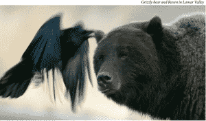
Here is my short list of do’s and don’ts for going back country in Yellowstone. Always carry bear spray and know how and when to use it. To lower the odds of a bear attack while in Yellowstone make noise while hiking, slowing down where visibility is low, like twisty trails, dense forests or over hill tops. This is especially true while hiking in the open sagebrush fields of Yellowstone because grizzly bears dig for roots and tubers amongst the sagebrush. Pay attention to wind direction and strength. If it’s blowing towards you, it can muffle your sounds and lessen the bear’s ability to smell you. Stay aware of your surroundings. Hike in groups of 4 or more people. Check for areas that are closed for hiking due to high bear activity. Almost always carry a raincoat; err on the side of caution. Have a plan on what to do if you meet a grizzly or horse on the trail. Wear shoes that are comfortable and sturdy enough for your ankles. Depending on the time of year and weather forecast, take extra cloths for warmth, bug repellent, suntan lotion, a hat and sunglasses. I highly recommend wearing hiking pants with zip-off legs, so you will always have hiking shorts with you. Take a map and water. Be aware of the weather forecast. Just so you know, it can snow just about any day of the summer. On June 14, 2001, just outside the northeast entrance, Silver Gate received 17 inches of snow. Watch out for lightning, especially on ridges or mountain tops. You must get a hiking permit for overnight camping, which, in Yellowstone, is allowed at designated campsites only.
No permits are required for day hiking.
A word of caution about hiking Yellowstone. With trail elevations varying between 5,300 and 10,000 plus feet, even the shortest hiking trail can seem grueling. Try to get in shape before coming to Yellowstone. Be aware of group members’ health issues, particularly heart problems with the elderly, for these may be compounded by the high elevation.
What follows are my favorite Yellowstone hiking trails. Now, Go Hike!
(Total hiking time one hour or less)
Trout Lake is a popular hiking trail that is approximately 20 minutes one way, with a steep 300 foot gain in elevation. If you hike this trail between June 10 and July 25, there is a good chance that you will see spawning trout. During high snow melt years the trout may not began their spawn till the first week in July. The trail arrives at Trout Lake where a small stream flows out. You want to walk around the lake to where a small stream flows in. This inlet and stream are where the trout spawn. Sometimes otters can be seen feeding on the trout. The trailhead is about a ¼ mile west of Pebble Creek campground.
Yellowstone Picnic Area is the trailhead for a wonderful hike that hugs the edge of the lower end of the Grand Canyon of the Yellowstone in a stretch known as the Narrows. There is a 75 ft gain in
elevation at the beginning of the trail, but the path is relatively level hiking after this. Steep ledges are found along this trail. Many people have fallen to their death in this area of Yellowstone. Don’t be one of them! I have often seen bighorn sheep, red fox and osprey while hiking this trail. Once, while sitting on a ledge near this trail that overlooks the Yellowstone River and observing an osprey nest, I saw a bighorn sheep and its five week old baby walk within a foot of me. With no time to walk away from the sheep and the trail too narrow for me to move out of their way, I just sat perfectly still while the bighorn mother and its little bitty baby walked right by me. Yeah, this was an experience I was lucky to have and will hopefully never forget. There are many great spots to sit, relax and eat a bite while overlooking the river. Watch out for the bighorn! You will hike about a mile and half from the trailhead to where the trail starts to turn east away from the river to join with the Specimen Ridge trail and at this point, I usually turn around and head back.
Medium Distance Hikes
(Total hiking time between 4 and 8 hours)
Slough Creek trail leads to some of the “best” fishing in Yellowstone and also to a really beautiful valley. Griz are frequently seen on this trail so be alert. After a 600 foot gain in elevation at the beginning, the trail levels out and continues through the 3 wonderful meadows for which Slough Creek is famous. This is a great day or overnight hike. Try to make it to at least the second meadow. I have woken up in the middle of the night to the northern lights streaking across the sky and then woken in the morning to howling wolves visible in the distance. The trail head is about 500 yards before you reach the Slough Creek campground.
Hellroaring Creek trail drops 500 feet during the first mile or so before crossing the Yellowstone on a rather large suspension bridge. Continue from here to a really sweet spot at the confluence of the Yellowstone and Hellroaring Creek. The confluence is a great place to camp out and the fishing can be quite good. Don’t count on catching any non-native fish species here, so bring your own food. I once met a kind, conservative, retired judge in Yellowstone who told me that he always brings home a stringer of fish from near here for his wife to cook up. I mentioned to the judge that he could only catch native cutthroat trout at that stretch of the river. He just looked at me with a smile on his face and said, ”No evidence, no case!” The trailhead is about 3 miles west of Tower Junction.
Mount Washburn is the hike for those who like big views. The hike has 2 trailheads. One trailhead starts at the Chittenden Road parking lot which is located on the north-facing side (Tower Fall side) of Mount Washburn. This route has little cover and the most open view. The other trailhead starts at the parking lots at Dunraven Pass. This route has more cover, maybe a slightly better chance of seeing wildlife and a good view of the Yellowstone caldera. Both trails are a long steady climb, not steep, just seemingly unending. Watch out for summer lightning storms and the building clouds that usually foreshadow them. These storms can ordinarily be avoided by hiking early in the day. Due to Mt. Washburn’s high elevation and snowpack, hiking is sometimes not possible until late June or mid-July. Depending on what time of year you plan on hiking, you might want to check with the rangers to inquire about conditions. Mount Washburn has a forest of whitebark pine trees which squirrels and grizzlies like to eat. So, be on the lookout for grizzlies. I wouldn’t worry too much about the squirrels! Bighorn sheep are frequently seen along the trail. The flower show on Mount Washburn is one of the “best” in the park. Flowers start to bloom in early July, and the show lasts until around mid-August, depending on summer rains. If the skies are clear, look to the south and you should see the Grand Teton Mountains 100 miles in the distance. Enjoy the view!
Bunsen Peak/Osprey Falls trail takes you over Bunsen Peak and then on to Osprey Falls. This trail is not for flat land walkers. There will be large gains and drops in elevations, but it’s worth every step. There are usually not many animals except for the occasional grizzly or bighorn sheep. You can shorten the severity and length of the hike by walking around Bunsen Peak along the Bunsen Peak loop. However, it is still quite a drop in elevation (700 ft.) to the falls. Osprey Falls is quite a beautiful waterfall, and I have spent many warm summer afternoons cooling off in the mist near the base of the falls. This is a sweet spot for a picnic. Bicycles are permitted on the Bunsen Peak loop road. The trailhead is about 3 miles south of Mammoth, where the Bunsen Peak loop gravel road meets the paved road.
Long Distance Hikes
(Total hiking time one grueling day to multiple days)
Specimen Ridge Trail is another great trail for those of us who like big views. I suggest starting at the west end of the trail and hiking east. Either way, the hike is long, so please start this hike early in the morning. After a quick 600 foot gain in elevation, the trail takes on a more modest rise in elevation until dropping 2,200 ft back into Lamar Valley. The total length of the trail is 17 miles. At the east end of the trail, you must ford the Lamar River. Be sure to check with the park rangers as to the current conditions of the Lamar River before starting out on your hike. There is no camping allowed on Specimen Ridge. You must be able to read a map because the trail is not well marked. This is a long trail so come prepared. Make sure that you have plenty of water because there is not much water available on the mountain. Be on the lookout for thunderstorms and associated lightning. This is one day hike that you always want to take a raincoat with you, no matter what the weather forecast is. Specimen Ridge gets its name from all the petrified wood and minerals found in the rock layers making up the Ridge. I start at the trailhead near the glacier exhibit pull-off (about 1.5 miles east of Tower Junction) and end the hike at the Lamar River footbridge pull-off (about 1/2 mile east of the confluence of the Lamar and Soda Butte Creek.)
The Shoshone Geyser Basin/Ferris Creek hike is my favorite hike. This may be because I am a hot spring junky and the fact that soaking in Ferris Pool Hot Springs is very definitely addictive. The hike starts at the Lone Star Geyser trailhead (about 1 ½ miles southeast of Old Faithful) and continues to the Shoshone Geyser Basin where I would spend the first night. This would make the first leg of your hike only about 8.5 miles. This Yellowstone backcountry basin is a magical place where one can wander around without having to stay on boardwalks because there are none. People and animals have died here by falling in the hot pots. Use extreme caution and good judgment. Once, while wandering in the basin, I came upon a clear hot pool with a fully articulated bison skeleton at the bottom of the pool. It probably slipped on ice during the colder months. Once in the pool, it wouldn’t have stood a chance. I suggest reading a book called Death in Yellowstone by Lee Whittlesey in order to more fully appreciate just how careful one needs to be while in Yellowstone’s wilderness wonderland. On the second day, hike to Ferris Pool Hot Springs. This hot pool, approximately 30 ft in diameter, is located next to Ferris creek. Part of the creek actually runs into the hot springs. In the middle of the pool is what seems to be a super-sized jet for a hot tub. The jet itself is about 18” in diameter and comes out of the bottom of the 30-inch deep pool with enough force to roll and churn the surface with bubbly, very hot water. As with all geothermal areas, great caution should be exercised. Test the water before entering and be aware that the water gets hotter the closer you get to the jet itself. Try to reserve the Three Forks camping site. This will put you closer to Ferris Pool in case you want to take a dip on the morning of your departure. Nakedness is allowed at this hot springs as long as other swimmers do not mind. No soap allowed in the hot springs.
Once, when hiking to Ferris Pool Hot springs, I misread the weather forecast. After a soak in the pool that evening and a great night’s sleep, I woke up to find my tent blanketed by fog. I just lay in my warm sleeping bag and waited for the fog to break. Nature called (had to pee) before the fog broke. As I got out of the tent and into the fog, you can imagine my shock and surprise as the fog outside my tent door turned out to be a 3 ft snowdrift blocking the exit from my tent. It had snowed 14” at my elevation. Knowing that I had to cross the continental divide on the hike back to the car, that the snow might be deep and the hiking slow going, I quickly broke camp, put on my waterproof rain suit and gaiters (without them, the hike out would have been a real bummer), and headed back to the trailhead. The snow near pass was 28 inches deep, with drifts up to 4 feet. There were no trees at this point and any trace of the trail was completed covered. I slugged my way across this treeless area until I came to the edge of the woods where I started to look for one of the orange trail markers that the Park Service periodically attaches to trees in order to mark the hiking trails of Yellowstone. It took me 20 slightly frustrating minutes to find the orange blaze. But I found it! All of this while carrying a 40 lb. pack. After 9 hours of hiking and 13 of the 15.5 miles of the trail with at least one foot of snow on it, I arrived back at my car just before dark with sore legs and a new story!
The Thoroughfare Trail is one of the most remote trails in the lower 48 states. For backcountry beauty, I have been on no other trail that beats it. The valleys are wide and the surrounding mountains are majestic. The fish are large here when you find them. This is definitely a multi-day hike. The Park Service offers a boat ride (it’s not free) across the lake that will shorten the hike. Otherwise, the trailhead is located 10 miles east of Lake Junction on the East Entrance Road. I suggest a fall time frame for this hike. Four days and nights fighting the blood-sucking mosquitoes would get a little old. There are a lot of animals around this part of the park. You might not see them, but you will probably come across some of the freshest grizzly prints pressed into the trail that you will ever encounter. You might not want to forget your bear spray on this hike. At one place in the Thoroughfare region, in an area called Two Ocean Plateau, a creek actually splits into two streams with one flowing to the Pacific and the other flowing to the Atlantic.
Let me close this section by saying that there are over 1,000 miles of hiking trails in Yellowstone and even though I have been hiking here for over 25 years, I have not been on even 50% of Yellowstone’s trails. As the years go by, I hope to find another trail or two to add to my favorite list. Or maybe you will. Some days I have been on a trail and not enjoyed the hike and then other days I have hiked the same trail and had a great time. Just as with life in general, attitude seems to make a big difference when I hike. I really do believe that there is a lot of magic to be found in nature and sharing this magic with you is the “best” reason to write about my favorite Yellowstone hiking trails. Wherever I am, wherever you are, there is magic to be found, if we just have the “best” attitude